
Table of Contents
Often described as one of the most remote US National Parks, Big Bend is truly a fascinating place to visit. Located in the western corner of Texas, it defines a small section of the US/Mexico border. Big Bend National Park encompasses the Chisos Mountains, part of the Rio Grande River, and a tiny area of the Chihuahuan Desert. These are not only interesting features, but also unique habitats for the various plants, trees, and animals that live there.
Big Bend had always been on our US National Park Bucket List. So, when we finally got around to planning a trip there, everyone was excited to see this incredible part of Texas. My parents, my husband, our two daughters, and I spent two wonderful days at the park right after Christmas, and enjoyed every minute of it.

My daughter Angie, my mom Mariana, and me…three generations together!
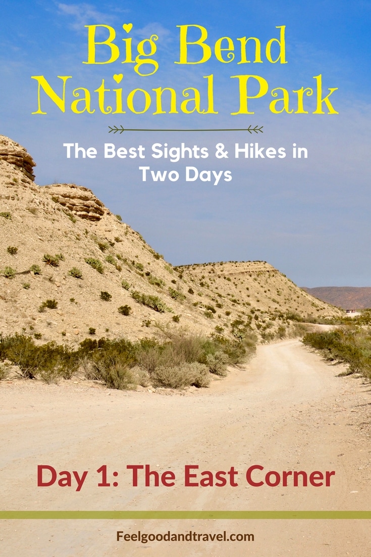
Big Bend National Park, First Impressions
Our first day in Big Bend began with a quick breakfast, followed by a short stop at a small convenience store not too far from the west entrance. When all of us were set with food, water, and other goodies, we headed towards Big Bend. My husband and I were excited to finally see one of the national parks in Texas, after living in The Lone Start State for a number of years!

The little market outside the west entrance to Big Bend National Park.

I found an old Chevrolet truck near the Market!
As we were getting closer to the park, we noticed a stunning desert view with jagged peaks in the distance. Naturally, we stopped a couple of times to snap some pictures of these unusual Texas sights.

The road leading to the west entrance to Big Bend National Park

Jagged peaks near the west entrance to Big Bend
Before long, we arrived at the entrance station near Maverick Junction, located on the west side of the park. This marked the official beginning of our journey throughout Big Bend National Park. Our basic plan was to get to the farthest point in the park without too many stops, and then slowly make our way back.

Big Bend National Park map, found near the west entrance
We continued to follow the main road straight ahead passing the Castolon/Santa Elena Junction and the Chisos Mountains Basin Junction.
Stop at Panther Junction Visitor Center
After some time cruising on the main road, we arrived at Panther Junction Visitor Center, which is also the Park Headquarters. Inside, we picked up junior ranger booklets for the kids, and asked for hiking and sightseeing suggestions from the park rangers. This is something we always do before beginning our explorations of a new park. To me, it was particularly important to get to know well one of the national parks in Texas, since The Lone Star State was also our home.
Watch the Movie about Big Bend
At Panther Junction Visitor Center, we also had a chance to watch a beautifully-made movie about Big Bend National Park, which was the perfect introduction to this fascinating place. I highly recommend that you see it too, if you visit! It will help you gain much better understanding of this whole area!
Hike Panther Path
Trail: EASY, wheelchair accessible path, 50-yard loop
Before continuing on with our drive, we took a brief walk right outside Panther Junction Visitor Center. There was a short trail called Panther Path, and it earned our kids an extra Junior Ranger patch, for which they were very excited! It was actually a really interesting trail as it weaved through a garden that featured many of the park’s unique plants.

Yucca plant along Panther Path in Big Bend National Park

Havard Agave on Panther Path. Although it is known as “century plant,” it doesn’t actually live that long. It only lives from 8 to 30 years. The Havard Agave blooms only once in a lifetime, and then it dies.

A Prickly Pear Cactus found along Panther Path…this one doesn’t actually have needles like some others. There are several different kinds of Prickly Pear Cacti.
After talking to the park rangers, watching the movie, and taking Panther Path, we felt empowered with knowledge, and ready to explore! This is why, I highly recommend that you, too, start your Big Bend journey here, at Panther Junction Visitor Center, the Park Headquarters!
Continue Driving East
We got back on the road, and continued following our plan. We were aiming to get to the farthest eastern point in the park, Boquillas Canyon, then slowly make our way back. Although we weren’t planning on really exploring anything until Boquillas Canyon, we did make a few short stops at different points of interest along the way.
Tunnel and Rio Grande Overlook
Our first stop was at the small tunnel on the main road, which looked really interesting lined by jagged rocks in the background. My mom and I, the main photographers, just had to snap a few pictures here.

Small tunnel in Big Bend National Park near Boquillas Canyon on the east end of the park
As soon as we crossed under the tunnel, we pulled over again to check out the views from Rio Grande Overlook. We couldn’t really see the river too well from here, but the view was quite nice regardless – a vast desert with large rocks in the distance, and desert plants all around.

View from Rio Grande Overlook near the east end of Big Bend National Park.
While these two stops were nice, if you are running short on time, proceed towards the end of the road, as there is more interesting stuff to see!
Boquillas Canyon Overlook
The next point of interest along the way was Boquillas Canyon Overlook. This viewpoint was elevated above the Rio Grande, and offered great panoramas of the nearby Sierra del Carmen cliffs, as well as neighboring Mexico across the river.

View from Boquillas Canyon Overlook – the Rio Grande River with the cliffs of Sierra del Carmen behind
On the Mexican side, we could see several peacefully grazing horses, and a few Mexican people who waved at us. Interestingly, one thing we could not see from here was the actual Boquillas Canyon! A sign nearby explained it all:
The massive cliffs of the Sierra del Carmen appear unyielding, yet the Rio Grande has carved a gorge 1,300 feet deep directly through the escarpment. Boquillas Canyon is so narrow that the entrance is almost invisible at this distance.

Mexico, on the other side of the Rio Grande River, as seen from Boquillas Canyon Overlook.
Adorable Mexican Souvenirs
On the US side of the Rio Grande where we were standing, we spotted a large rock. On top of it, there were a whole bunch of colorful souvenirs, hand made by people from Boquillas del Carmen, Mexico, a small village on the other side of the river. Most of the souvenirs were shaped like insects, plants and animals, beautifully made from beads and wire. They were just left there for us to purchase. We found the prices on a plastic jug, which contained the money that people had left.

Angie and Dani having fun with the little souvenirs left by the people of Boquillas del Carmen, Mexico.
My mom and I decided we had to get a couple of these little Mexican crafts, and we gathered enough cash. After we put the money in the plastic jug, we picked out a couple of adorable bead and wire scorpions. They were going to always remind us of this day in Big Bend National Park!
TIP: The National Park Service strongly discourages visitors from purchasing souvenirs left in the park. It encourages illegal crossing of the Rio Grande River and endangers the lives of the Mexican people who bring the souvenirs into the park. We only came to realize all this much later. My advice is, don’t do what we did!
Hike Boquillas Canyon Trail
We took a little bit longer to enjoy the views from the overlook, and then continued driving further east. From here on, it wasn’t long before we reached the parking area for Boquillas Canyon Trail, which was also the end of the road. We had planned to hike into the canyon, so we all got our water-filled backpacks and hiking poles, and started following the trail.
A River, a Canyon, and Friendly Mexican People
Trail: MODERATE unpaved path, 1.4 miles round trip
At first, the path took us up a bluff, which once again revealed beautiful views of the Rio Grande. Our two daughters Angie and Dani were not particularly happy that they had to climb this semi-steep section, but they did just fine. This initial ascent was perhaps the most difficult part of the trail.

View of Rio Grande River from Boquillas Canyon Trail
From here on, the path descended gently down to the river and into Boquillas Canyon.

My dad Ivan, Dani, and Angie walking on Boquillas Canyon Trail

Getting closer to the actual canyon
The trail in the canyon was quite flat and easy, a relaxing walk along the Rio Grande. As we descended down near the river, we saw a Mexican man who was singing in Spanish quite nicely. He also had more of the wire and bead souvenirs for sale. We greeted him, and continued our hike.
Just then we noticed another man sitting on the other side, the Mexican side of the river, who waved at us in a friendly manner. We all waved back at him, and stood around for a bit to look at the calm water. Since the Rio Grande is not very wide at this point, it was really odd to think that the man was actually in Mexico.

Finally surrounded by the walls of Boquillas Canyon; the Rio Grande is pretty calm down here
Hike Deeper into the Canyon
We continued our hike deeper into the canyon, and as we looked up at the steep walls, we noticed a tiny cave in the rocks above us. A few young people were trying to climb up there. Our kids saw them, and immediately decided they, too, wanted to get up to the cave. Since hubby and I didn’t agree to that “bright” idea, we had to quickly come up with something to stop the whining that ensued.
Just then, we all noticed that the trail was getting more sandy and rocky. This caught the kids’ attention, and they quickly forgot about the cave and focused on jumping on and off the rocks.

Dani near the end of Boquillas Canyon Trail
We followed the path for a while longer, to a point where the walls of the canyon met the river. It became clear that this was the end of the trail, since there was no possible place to walk any further.

Dani, my dad Ivan, and Angie sitting on a rock at the end of Boquillas Canyon Trail
Head Back When the Canyon Walls Join the River
Mesmerized by the beautiful scenery, we slowly turned around and started making our way back.

Dani hiking back on Boquillas Canyon Trail. She is always running in front of everyone else!

One more look at the muddy Rio Grande before heading out of Boquillas Canyon
Once again, we saw the Mexican man who was singing earlier,standing under a tree with all the bead-and-wire souvenirs. This time, he stopped us to ask if he could buy any food from us because he was terribly hungry. We gladly handed him a couple of our sandwiches and a tangerine, and of course refused to accept any payment. We were just happy to help him out, and to unload our backpacks a bit!

One final view of the Sierra del Carmen cliffs, and the hidden Boquillas Canyon. Can you see the opening to the canyon?
Start the Journey back West
When we got back to the car, we all had a quick lunch with whatever was there, and then started driving again. Boquillas Canyon is at the end of the road, so there was only one way to go – back! We had already seen a lot of the views along the way, but there were still a couple of places that we wanted to visit.
Visit Rio Grande Village
After driving for a short while, we took a left turn towards Rio Grande Village and Daniels Ranch. Once there, we stopped at the small convenience store and picked up Coca Cola drinks in glass bottles. The cashier referred to them as Mexican Cokes. Regardless of whether they were Mexican or American, they tasted really good! The loads of sugar and caffeine helped give us a much needed boost of energy!
Stop by Daniels Ranch
Next, we walked over to Daniels Ranch, an adobe building made of dried mud and other Earth materials. The tiny ranch was constructed in the typical style for the area. We learned that it was used as a shed before becoming a residence. A couple, named Mr. and Mrs. Daniels, lived there until about 1944, the year Big Bend was established as a national park.

Daniels Ranch near Rio Grande Village
I thought the most beautiful sight, however, were the trees right across from the ranch. Since it was late December, their leaves had turned beautiful, bright fall colors, something we don’t see very much in Texas.

Beautiful fall-colored trees near Daniels Ranch in Big Bend National Park

The large trees near Daniels Ranch grow close to the Rio Grande River, a different habitat from the arid desert

…And one more picture of the fall-colored trees near Daniels Ranch
We noticed that there was a trail that started near Daniels Ranch, and it led to Hot Springs. This was actually our next and final point of interest for the day. The trail from Daniels Ranch, however, was 6 miles round trip, which seemed a bit long, considering it was getting late in the day. So we decided it would be best to drive as close as we could get to Hot Springs, rather than hike all the way from Daniels Ranch.
Hike Hot Springs Historic Trail Loop
We returned back to the main road and drove for a bit, passing under the same tunnel we had seen earlier. Then, we took a left turn onto a dirt road, which lead to Hot Springs.

The road to Hot Springs in Big Bend National Park
Neither my parents’ car nor our car were suitable for off-road driving, so we took it really slowly. The road was dusty and a little rough, but we were determined to get to Hot Springs. The kids were also excited, since hiking the historic trail would give them another Junior Ranger patch.
After about two miles or so of driving in the dust, we arrived at the parking area where the Hot Springs trail began. From the signs there, we understood that there was a mile-long looping path that would lead us back to the parking lot.
Resort Remains, Giant Palm Trees, and Hot Springs
Trail: EASY unpaved path, 1.0-mile loop
We started walking, and the first thing we noticed was an old, abandoned, stone building, which I later found out, used to be a convenience store, and a part of a former resort.

The old convenience store at the beginning of Hot Springs Historic Trail
A little further down the path there was a picnic table, placed near several giant palm trees. They were bunched together, and looked really impressive!

The giant cluster of palm trees on Hot Springs Historic Trail

Me looking up at the palm tree giants

Walking on Hot Springs Historic Trail in Big Bend

Here I am, on the Hot Springs Historic Trail

Interesting rocks on Hot Springs Trail in Big Bend
The trail descended gently until it leveled off near the Rio Grande river. It wasn’t long before we arrived at the hot springs, and saw several visitors soaking in the water. It was a small area at the edge of the river that was enclosed with what looked like stones and concrete. This is what separated the hot springs from the fast-moving waters of the Rio Grande. We didn’t intend to soak in, so after a few minutes of watching all the happy, bathing folks, we continued walking further along the trail.

Visitors bathing in the hot springs near the Rio Grande River in Big Bend National Park
Swing Back around and Climb the Bluff
After a short while, we came to a point where the trail split. One path lead to Rio Grande Village, and the other back to the parking lot. The latter was the one we needed. This path lead us to the top of a nearby bluff, from where beautiful views of the park and the river opened up. The sun was getting lower and the warm colors along with the pleasant cool temperatures made this a truly enjoyable walk.

View from Hot Springs Trail in Big Bend

My parents hiking to the top of the bluff on Hot Springs Trail, on the way back to the car

Another view from Hot Springs Trail. This was behind us as we were climbing up on the bluff.

The Rio Grande as seen from the top of the bluff on the looping trail at Hot Springs

Angie, hubby, and Dani finishing Hot Springs Loop Trail
I highly recommend you do this mile-long loop in the late afternoon hours, as it is a very relaxing hike. You may even want to bring your swimsuit and a towel, and take a dip in the hot springs!
Watch for a Stunning Big Bend Sunset
We returned to the car, and started the long drive back out of the park.

Back on the one-way dirt road out of the Hot Springs area
Once on the main road, we didn’t make any more stops, except for one. As we got closer to the Chisos Mountains Basin Junction, we observed beautiful sunset panoramas. The sun was about to dip below the horizon, and was illuminating the scattered clouds with the final rays of the day. My mom and I just had to stop, and put our photography skills into practice. It was absolutely stunning and completely worth taking a few minutes to capture and admire the view.

Sunset over the Chisos Mountains in Big Bend

More amazing sunset skies over Big Bend

Chisos Mountains under a burning sunset sky
Enjoy a Unique Dining Experience at La Kiva
After this perfect ending to a great day, we exited Big Bend on the west end at Maverick Junction. The next order of business was to find a place to eat dinner. While there isn’t much of a choice in this neck of the woods, we managed to discover a funky restaurant, called La Kiva. The food was quite good, but the really interesting thing there was the atmosphere. It almost felt like we were eating in a cave. Out of curiosity, I looked up the meaning of the word “Kiva”. The Merriam-Webster dictionary defined it in terms that pretty much described this place:
a Pueblo Indian ceremonial structure that is usually round and partly underground
La Kiva Restaurant & Bar also has some pretty twisted history, which you can discover on their website. I recommend that you check this place out to get a taste of the local food and culture!
Exhausted but satisfied, we returned to our lodging for the night, and quickly went to sleep thinking of all the beautiful things we had experienced that day. I, for one, couldn’t wait to get to know the rest of Big Bend. It was exciting to discover more of the surprises and mysteries in one of our national parks in Texas.
Additional Resources to Help Plan Your Big Bend Adventure
- The Official NPS Website for Big Bend – This is the official Big Bend website by the National Park Service. Here, you can find the latest information about the park, maps, active alerts, and much more
- National Park Reservations: Big Bend National Park – On this website, you can find a variety of lodging options inside and near Big Bend National Park
- Visit Big Bend – Another website specifically dedicated to Big Bend National Park and the surrounding area.
- Big Bend National Park MAP – Here, you will get a PDF copy of the latest Big Bend National Park Map. It is identical to the one you will receive at the entrance
- Big Bend River Tours – Check out this website for information about river tours on the Rio Grande, an amazing way to experience the park
Big Bend Hikes: Information & Specifications
- Desert Hikes in Big Bend – A webpage created by the National Park Service that provides information about all the hikes you can take in the Big Bend desert regions
- Mountain Hikes in Big Bend – Another webpage by the National Park Service that lists all the hikes you can take in the Big Bend mountain regions
- River Hikes in Big Bend – Yet another page by the National Park Service, where you will find specific information about the Big Bend river hikes discussed in this post, and a few others
Note: Unless otherwise indicated, all photos in this post were taken by me (Vessy) with my Nikon D3100 camera, and iPhone 6. All images are subject to copyright. Please contact us if you would like to use any of them!
This trip took place on December 27, 2016.
PIN THIS POST! 🙂
Big Bend National Park Day 1 Pin
38 comments
I would love to hike here. The terrain is so different. Soaking in a hot spring after a long hike would be awesome.
It is such a wonderful park…so diverse, too. You can even cross the border if you like, and visit the cute Mexican village of Boquillas del Carmen! I would love to do that sometime soon!
In the next Big Bend post, I will cover the park’s most famous point of interest, Santa Elena Canyon and also the Chisos Basin! I truly love this pocket of Texas! It feels so remote, so isolated…like a very peaceful Wild West! 😁 …And it is gorgeous! 😊❤️
Wow! You have such a great eye for photography. I really felt like I was there! Beautiful sites and sounds of Texas, and you captured it amazingly. Great post!
Thank you so much for this nice comment! I really appreciate it! Big Bend totally took me by surprise with its incredible variety and beauty! 😊❤️
Looks like y’all had fun! I’m from Texas so it’s nice to see parts of my home state getting some love ❤️ my first career was a biologist and I spent many nights camping down in big bend!
Aww, now cool! I would definitely enjoy camping there sometime in the near future…hopefully! ❤️😊❤️
Looking forward to traveling to this area. We, too, are from Texas and have never been here. My kids enjoy hiking and filling out the Junior Ranger books so it looks like a place they would really enjoy.
They would have so much fun for sure! It is such a stunning place, and I have not even covered Big Bend’s most iconic sights yet. Those are coming in the next post…Santa Elena Canyon, the Chisos Basin, Ross Maxwell Scenic Drive…I really loved it, and can honestly say, Big Bend totally surprised me, and surpassed all of my expectations! 😊❤️😊
Looks beautiful! I would love to visit there one day.
You would enjoy it! It is a very peaceful place! 🙂
Love the descriptions and the photos. The Rio Grande looks as magical as in the old John Wayne movie. The trees in the Rio Grande Ranch are spectacular. I am trying to figure out the species. And love the giant palm. Another great post.
Thank you so much Verla! I was totally thinking of you when I posted all those tree pictures! 🙂 I loved them so much, that I couldn’t choose just one photo…I kept them all! 🙂 Thank you so much for stopping by! I really appreciate it!
Wow! This is stunning! Soaking in a hot spring would be amazing!
It did look really wonderful, especially on this pleasant, cool, December evening! Next time, I am definitely bringing my swim suit! 🙂
Such a beautiful corner of the world! Thanks for the memories! (8th grade trip) 😁
How neat that you were there in 8th grade! 🙂 I really loved it there…a peaceful Wild West! 🙂
My family and I were just talking about adding a national park tour to our vacation plans so this is some timely. Thanks for all the details. And I also love that tunnel picture!
Thank you so much! Spring is perhaps the best time to visit Big Bend…it is nice and warm, and very pleasant for hiking. It is a beautiful and peaceful place, not too many people, not too much traffic! Stay tuned for one more post from Big Bend, when I cover the park’s most iconic spots, Santa Elena Canyon and Chisos Basin.:)
What breath taking photos. I would LOVE to go to the hot springs. I’ve only been to Texas once but didn’t have the opportunity to see many sites. It’ll have to be on my list of places to visit again.
For sure! Texas has a lot of beautiful places…Hill Country, San Antonio, Austin…Big Bend and Guadalupe Mountains National Parks :)…and this is just through the middle of the state! I honestly think it is one of the prettier states in the country! 🙂
That looks like a beautiful place to visit.
It really surpassed all my expectations! Stay tuned for the next post where I cover Santa Elena Canyon, the park’s most famous spot! It is stunning! 🙂
Looks like a beautiful place to visit- especially with those sunsets!
I knooow! The sunsets out in West Texas are really incredible! I always feel the colors are more vibrant there! 🙂
I absolutely love the photos! Sounds like a neat adventure!
Thank you so much! It was truly a great experience! 🙂
I love hiking! Those trails look amazing! I will put this on my traveling wish list!
I am so happy you stopped by! Yes! You will definitely enjoy Big Bend…there are hikes in the desert, hikes in the mountains, and hikes near the river. I included links to all of them at the end of the post.It is a peaceful place…no crowds, no traffic! 🙂 I sure hope you visit soon! 🙂
Wow so beautiful. If I’m ever in the area I’ll know where to go 🙂
Thanks so much! Definitely worth a visit! 😊❤️
I loved all your pictures! It looks like a fun place to explore. All the hiking looks like fun! I enjoy hiking with my family as well
Thank you so much for stopping by! 🙂 It truly is a beautiful place…so peaceful…just you and Mother Nature! 🙂
Great photos! My favorite is that little tunnel through the rocky landscape. I love the brick facing.
Thank you so much! Yeah, it’s a cute, little tunnel! 😊❤️😊
This National Park seems so charming and breathtaking, Vessy! I am definitely adding Big Bend to my bucket list. When’s the best time of the year to explore it?
Thank you so much for stopping by Agness! 😊❤️ Anytime from October till March is very pleasant, not too hot! We went there right after Christmas, and the weather was beautiful. Spring break is the most popular time, though! 😊❤️😊
beautiful pictures. I have always been fascinated by the desert, from afar. haha
Thank you so much! Yes, the desert can truly be a fascinating place. Big Bend is unique because it actually combines three distinctive habitats: desert, river, and mountains. The desert is the dominant one, though! 😊